Reading the historic city
Chicago's surviving buildings, streets and spaces are a window into lives once lived. This course uses physical evidence with archival resources to "read" the historic city, understand how city life once worked, and interpret what this knowledge means for contemporary urban challenges.
Exercises for this course are listed at the bottom of the page, below all sections.
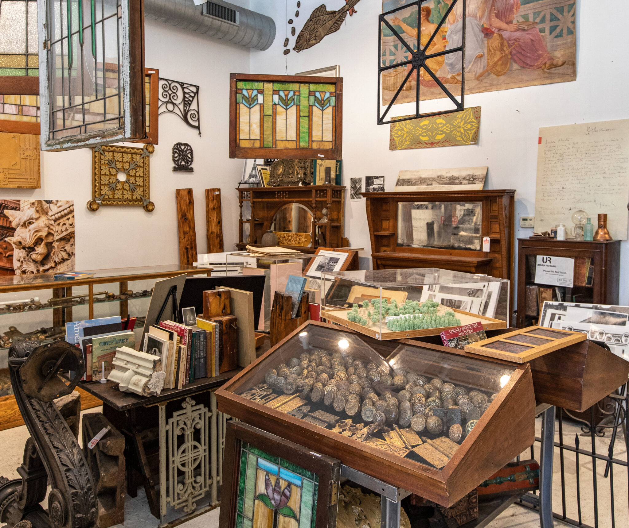
Urban remains
What remains of the historic city?

Life close by
The historic city had a remarkable diversity of uses close to where people lived.
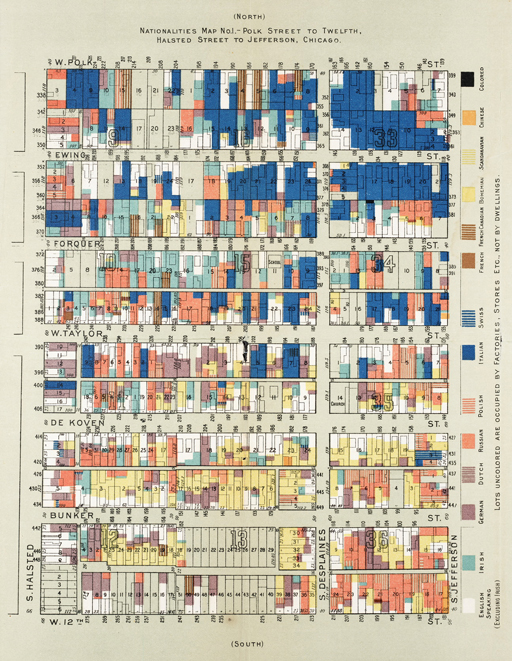
Social concentration
How socially concentrated was the historic city?
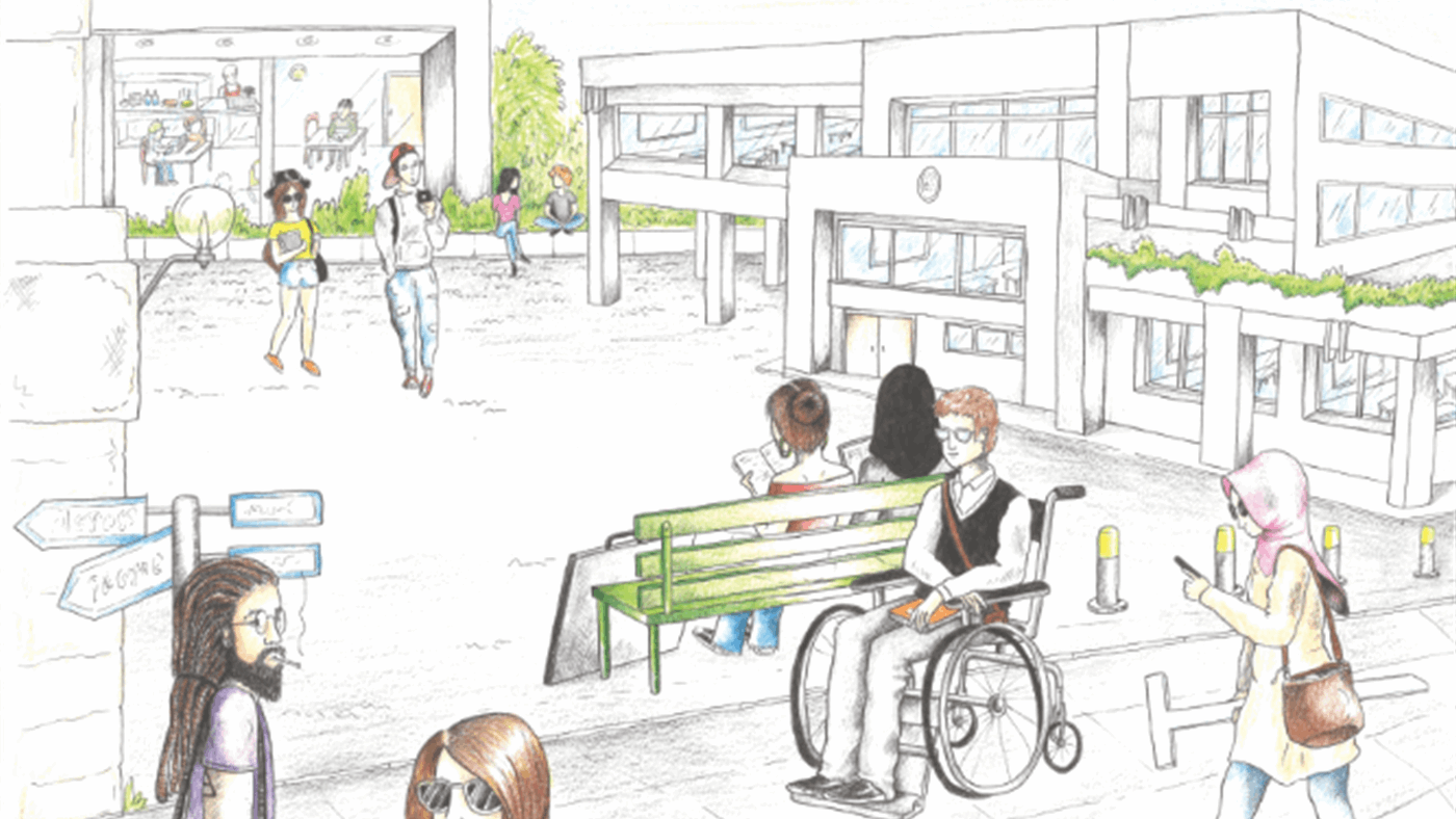
Social mixing
The historic city was socially mixed, but there were plenty of ethnic enclaves.

Civic spaces
What institutions did below rely on?
Exercises
Exercise 1
Find a block in Chicago, anywhere in the city, where you can "feel" the past when you walk down the street. This does not need to be a block with especially well-preserved buildings or signature architecture, it just needs to feel like the past is still present.
Try to imagine what the past was like when you walk down the street. Take plenty of photos and jot down notes. Then write a short response to the following:
- Describe the physical evidence in terms of building types, frontages, storefronts, or materials — anything that gives a sense of how the block once functioned. Document with photos.
- Next, describe how you think the block once functioned. What do you think was the level of activity here?
- Finally, describe how you think the block has changed — what survived vs. what is more recent or new. What does the change and the mix of old and new signal about life on this block?
Be prepared to talk about your block in class next week.
Final product
- Written response (500 words max)
- Photos (10 max)
- Small map showing where the block is
Exercise 2
Investigate the history of transit stations in Chicago (chicago-l.org) and street car lines (Encyclopedia of Chicago) and select an area to study. Include a ½ mile area around the station or ¼ mile around the streetcar corridor.
- Open Google Earth and navigate to the station area/corridor you want to study.
- Use Add Path or Polygon and draw a ½ mile polygon around the station or a ¼ mile polygon around the streetcar line.
- Save/export that polygon as a KML file.
- Upload that KML to Claude with this prompt: I have attached a KML containing a polygon defining my study area. Extract the polygon coordinates and give me the exact values I need to enter into the Cook County CookViewer parcel REST Query page to select all parcels that intersect this polygon. Use spatial reference 4326. Give me the exact entries for Where, Input Geometry, Geometry Type, Input Spatial Reference, Spatial Relationship, Out Fields, Return Geometry, Output Spatial Reference, and Format.
- Go to the Cook County Query page and enter the following:
- Where: BLDGAGE >= 126 (or 100)
- Input Geometry: copy what was returned by Claude
- Geometry Type: Polygon
- Input Spatial Reference: 4326
- Spatial Relationship: Intersects
- Out Fields: PIN14, street_address, CITYNAME, BLDGAGE, BCLASS
- Return Geometry: True
- Output Spatial Reference: 4326
- Format: GEOJSON
- Click Query (GET).
The resulting GeoJSON contains only parcels that satisfy both conditions: inside/intersecting your drawn study area, and building age ≥ 100 years (or whatever date you specified).
Save the GeoJSON and upload it to Claude using this KML-conversion prompt: Convert the attached GeoJSON to a KML file that I can open in Google Earth. Preserve the parcel polygons; use a translucent fill with clearly visible dark parcel boundaries; include street address, PIN14, building age, and building class in each popup; and add a clickable 'View Historical Photo' link using https://maps.cookcountyil.gov/groundphotos/ followed by the PIN14 with punctuation removed.
Final product
- Submit your completed Google Earth KML and several screenshots illustrating your findings.
- Provide a short written analysis answering the central question: What are the historic remains of your station area or transit corridor? Is there a pattern to what remains? Were you surprised by what you found, and do you think it has an impact on the neighborhood's identity?
Exercise 3
1. Choose and download a historic Sanborn map
- Select a Sanborn sheet covering several blocks of your study area.
- Search the Library of Congress site, or log in via UChicago — click on interactive map and enter an address.
- Download the highest-quality JPG available.
- Record the year, volume, and sheet number.
2. Georeference the Sanborn map
- Open Google Earth and navigate to the neighborhood shown on your Sanborn.
- Add → Image Overlay and add the Sanborn jpg.
- With the Image Overlay Properties window open, use the green controls to move, resize, stretch, and rotate (using the diamond shapes) the image.
- Use the Transparency slider in the Image Overlay window. You should be able to see the historic streets and the contemporary geography simultaneously.
- When satisfied, click OK.
- Save the georeferenced Sanborn. In the Places panel, right-click your Sanborn overlay, Save Place As… give it a file name and save as a KMZ.
3. Obtain the current-building file
- Download the City of Chicago Building Footprints KMZ from the Chicago Data Portal (click "Export" and save as KMZ). You will give this file to ChatGPT along with your much smaller Sanborn KMZ.
4. Upload both files to ChatGPT
Upload your georeferenced Sanborn KMZ and the Chicago Building Footprints KMZ, then use this prompt:
I have attached a historic Sanborn map that I georeferenced in Google Earth Pro and saved as a KMZ, along with the full City of Chicago current Building Footprints KMZ. Read the geographic extent and rotation of my Sanborn from its KMZ. Extract from the Chicago building-footprint file only the current buildings within the area covered by my Sanborn. Also trace the historic building footprints visible on the Sanborn image. Trace actual buildings and significant outbuildings, but do not trace text, lot lines, street lines, map symbols, or other non-building features. Create one Google Earth KMZ containing three toggleable layers: Current Buildings — current footprints as outlines only; Historic Buildings — traced Sanborn buildings as filled polygons; Historic Sanborn Map — the original georeferenced Sanborn image. Keep all current buildings together as one layer rather than displaying every building as a separate layer in the Google Earth Places panel. Stack the layers so that the Sanborn image is at ground level, historic building polygons are approximately 0.5 meter above ground, and current building outlines are approximately 1 meter above ground. This should ensure that the current building outlines remain visible above the historic layers. Preserve the geographic registration of my original Sanborn KMZ and give me the finished KMZ to open in Google Earth Pro.
5. Open the finished KMZ in Google Earth
You will see 3 layers in the Places panel: Current Buildings, Historic Buildings, and Historic Sanborn Map.
Check whether the automatically traced footprints correspond reasonably well to buildings on the original Sanborn. The tracing is generated through image interpretation and will not be perfect. You will mainly want to compare the Historic Buildings and Current Buildings layers to better understand building persistence, demolition and replacement.
Final product
- Submit your completed Google Earth KMZ and several screenshots illustrating your findings.
- Provide a short written analysis answering the central question: How much of the historic neighborhood remains and what has changed? Make use of the information contained on the original Sanborn, which will identify uses and materials. Also think about scale, density, and building coverage. Is there continuity? Do current streets, blocks, lots, setbacks, and overall building pattern still resemble the historic neighborhood?
Exercise 4
In this exercise we'll do two things: map the historic businesses that once existed in the neighborhood, and select 1 older historic commercial building and trace the businesses that once existed in that location.
1. Select a block with historic buildings (from Exercises 2 and 3)
- Try to find a cluster of businesses and include both sides of the street. We are only interested in tracking businesses for which the buildings are still there.
- Find a minimum of 4 Sanborn maps covering the blocks (you may include more). Search the Library of Congress site, or log in via UChicago — click on interactive map and enter an address.
- Sanborn key: loc.gov overview
- Deciphering Sanborn codes: guide document
2. Upload the Sanborn jpgs to Claude
Submit this prompt: These are Sanborn fire insurance maps. Extract all readable information about named businesses and companies, along with their addresses. You might get a list like this:
- The H. Piper Company Bakery — ~1600–1618 Wells St. area
- Chicago Railways Co. Material Yard — large lot in center/lower section (Block 2)
- V. Senb Terminus / Wagon [?] — Block 1, interior lot (partially legible)
- Old E. Schmidt Co. / Soap Works — southeast corner, near N. Park Ave.
3. Select a business that would have been a special asset to the neighborhood
A corner grocery would be a good option. Tracing individual business owners and where they lived says something about how neighborhood commerce operated — the social organization behind the storefront.
Polk directories allow you to search by address to find the relevant business or owner name; the Chicago History Museum has the 1928–29 directory online. Once you find a name, search on Ancestry.com or Newspapers.com for more information on that business owner. You could also search Ancestry.com's city directories to find out where that owner lived — was the owner living above the store?
Scour the internet for any relevant information about that business and its owner. Start with a simple Google search on the company name, which can often be very fruitful. Also try:
- Historypin.org — this site often has advertisements that can help recover vanished storefronts and forgotten businesses.
- Chicago Collections — search by neighborhood.
- Chicago Public Library neighborhood collections
- Chicago Public Library digital collections (history)
Example: searching by location in historypin.org, I found this business advertisement in my neighborhood: J. M. Barron & Sons Dairy. In Ancestry.com, I searched on "J. M. Barron" in Chicago. One of the returned sources was the 1900 census. From that you can find out a lot — ancestry, occupation, place of birth, and address. Joseph M. Barron, who was born in 1888, had 2 brothers and 2 sisters, along with a "servant" from Sweden and 4 "roomers" who were all "milk drivers." The father, Joseph Barron, was listed as a "milk man." Next, I searched on where he lived. The address on the 1900 census is "58 Grant Pl" but Chicago streets were renumbered in 1909. Use the street renumbering guide to find the new number (I was able to find his home, 514 Grant Pl., a beautiful historic row house).
Final product
- Write a 750-word description, with illustrations and photos, of what you found. Include a figure showing your Sanborns, pieced together in a composite image file.
- Describe what the remaining buildings reveal about the businesses the neighborhood once had. How integrated were these businesses with the surrounding residences?
- Provide a summary of your "deep dive" exploration of a single business and include illustrations. How would you characterize this building's history in terms of changes in use over time?
Exercise 5
1. Take a single block from the 1900, 1910 or 1920 census and list for every adult on the block:
- Name
- Occupation (exactly as written in the census)
- Birthplace / immigrant statu
2. Estimate the Work Radius
With your inventory, estimate a "work radius" for each occupation. How far away could a worker realistically walk to work, or take the streetcar or transit, for various occupations? For example:
- 0 miles / at home — piecework, laundry, taking in boarders, home-based retail
- Under ½ mile / walkable — corner grocery clerk, neighborhood saloon worker, local school teacher, small workshop laborer
- ½ to 2 miles / long walk or short streetcar — factory worker at a mid-sized plant, department store clerk, domestic servant
- 2+ miles / streetcar dependent — steelworker, stockyards laborer, railroad worker, large-scale industrial plant
3. Physically locate likely workplaces using your area’s existing urban remains.
- From the Sanborns, look for the nearest place of work that matches the occupation listed on the census and is within your estimated radius. Where were the closest factories or stores, still remaining?
- If the occupation is domestic servant, how far away were the wealthier neighborhoods where they were likely to be employed?
- Census information can be used to infer place of work. For example, if the occupation is shopkeeper or merchant and there is a store at the same address you might assume they worked there. Or if there are boarders from the same village in Poland as the landlord living in the same building you might infer that they all worked in the same place.
Final product
Submit your building type population estimates, a photo of each building type, and your Sanborn maps (ideally as a composite) showing the building type distribution. Include a table showing your calculations for population counts (by unit, building and neighborhood). Write a short (500 word max) summary of the archival and photographic evidence you found. What does this archival evidence show about the experience of density, and what is your interpretation?
Exercise 6
This exercise examines density through the evidence left behind in the historic urban landscape. Density was embedded not in towers but in the repeated use of “missing middle” housing, often mixed with single-family housing. We want to know much density this low- and mid-rise building fabric could support, and we want to try to understand what this social concentration was like.
- 1. Select a single neighborhood to study – either a ½ mile area around a transit stop or a ¼ buffer along a one mile long commercial corridor.
2. Estimate population based on building type. Find examples of single-family, two-flats, three-flats, four-flats, courtyard apartments, rowhouses, or small apartment buildings (ignore whether these were internally converted since they were built – we are investigating the original form). For each housing type, use census tables from 1900, 1910 or 1920 (from ancestry.com) to determine the number of units, the population per unit, and the total population of the building at each address.
3. With these estimates and using Sanborn maps, count the number of similar housing types and make an estimate of the total population for the neighborhood. For example, assume all two-flats in the block have the same occupancy as your sampled two-flat, and so on.
4. Use photos and other archival evidence to think about how your neighborhood’s level of social concentration was experienced. Density was an everyday experience shaped by proximity to neighbors, activity on the street, and the continuous presence of people. The surviving streets and buildings make it possible to interpret this lived environment and to consider both its benefits and its drawbacks. You will need to rely on photographic and descriptive evidence from historical archives, newspapers and other sources to get a sense of how crowding, noise, and limited privacy challenged social concentration.
Final product
Turn in your list from the census, maps with representative radii, and locations of workplaces. Write a short summary (500 words max) of your overall impressions of “work close by,” reflecting on what you found. You might think about, for example: gender patterns and mobility constraints (geography of women’s work vs. men’s); immigrant clustering (do people from the same country seem to have the same occupation?); skill differences ("laborer" and "machinist" might work at the same factory, but the machinist probably had more choice about where to work and might be less likely to live next to the plant); presence of professional people like lawyers and doctors (did they work out of their homes?).